Have loop, will travel: out in the field with a $20 FM antenna

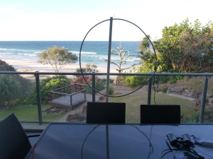
Beachfront © 2014 FM DXing

Beachfront © 2014 FM DXing

It’s not much fun going to the trouble of building any antenna without taking it out for a play, right?

Beachfront © 2014 FM DXing

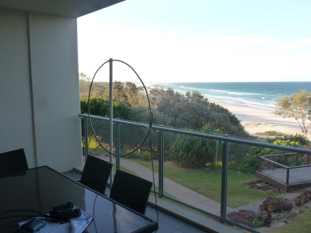
Beachfront loopy style © 2014 FM DXing

The FM loop antenna may offer satisfactory reception whilst travelling on vacation (above) or on a field trip. Under these situations, a small FM yagi antenna may be considered too obtrusive or unwieldy. The loop offers a compromise. Surely, that is an incentive to get out the city into some fresh air!

Example #1: Beachfront resort

On the small balcony of a 2nd floor beachside apartment, permanent tropospheric scatter reception from 80 kW public services northwest was possible at 354 km / 220 mi with this loop antenna.

Beachfront loopy style © 2014 FM DXing

Beachfront loopy style © 2014 FM DXing

‘Dead of winter’ conditions prevailed, which were typical for mid July. However, these signals were comfortably audible (e.g. strong enough to trigger Yamaha’s CSL) over five consecutive nights.

Beachfront loopy style (MTV Unplugged!) © 2014 FM DXing

Beachfront loopy style (MTV Unplugged!) © 2014 FM DXing

Fading occurred only very briefly. The maximum elevation on the balcony was 22 m / 72 ft ASL.

Beachfront listening © 2014 FM DXing

Beachfront listening © 2014 FM DXing

A component FM tuner was used at this apartment with the loop.

Beachfront listening, local reception © 2014 FM DXing

Beachfront listening, local reception © 2014 FM DXing

Example #2: D’aguilar Range portable field trip

At a secluded spot on the D’aguilar Range, the loop was mounted in the carpark on a three metre PVC mast. The circular antenna can be accommodated in a sedan by collapsing the rear seat.

Mountains loopy style © 2014 FM DXing

Mountains loopy style © 2014 FM DXing

Upon arrival on-site, the loop took less than five minutes to erect by moonlight (if one is lucky!) or torchlight. OK, so she ‘looks a bit worse for wear’ on this occasion, but nonetheless performs!

Mountains loopy style © 2014 FM DXing

Mountains loopy style © 2014 FM DXing

At this location, the lowest figures from the altimeter (taken between 10-10:30 pm) indicated an elevation of 468 m / 1,535 ft ASL with a warm ambient temperature of 10.8 degrees C / 51 F.

Mt Samson © 2013 Berknot

Mt Samson © 2013 Berknot

The spot was located between the SOTA (Summits On The Air) mountains of Sim Jue and Samson.

Mt Samson © 2013 Berknot

Mt Samson © 2013 Berknot

The date of the trip was early August at 10:30 pm. Despite a very congested FM dial, the following services listed below were heard in flat conditions with a tropospheric index of nil. These stations are never heard permanently at home during winter, apart from some of the northern reception. An obstructed southern path (which includes the McPherson range topping 1,359 m /4,459 ft ASL) may be the likely explanation.

Rebel logo © 2014 Rebel Radio Network

Hitz FM logo © 2014 Bundaberg Broadcasters

North

  • 3 kW commercial services at 274 km / 170 mi
  • 1 kW commercial service at 217 km / 135 mi

4DDD logo © 2014 Dalby Broadcasting

West

  • 2 kW community service at 145 km / 90 mi

Now FM logo © 2014 Moree Broadcasting

South West

  • 100 kW commercial service at 416 km / 258 mi

Ten FM logo © 2014 Ten FM Community Radio

Life logo © 2014 Life FM Community Radio

South

  • 15 kW commercial services at 331 km / 206 mi
  • 1 kW community service at 272 km / 169 mi
  • 100 watt commercial services at 169 km / 105 mi
  • 50 watt public translator at 163 km / 101 mi
Recording at mountains in car, loopy style! © 2014 FM DXing

Recording at mountains in car, loopy style! © 2014 FM DXing

A brief check with the car radio indicated that the majority of these stations were not audible with the car radio antennae. This suggests that the loop was performing as it should. In fact, one of the 5 kW commercial services located 77 km / 48 mi south was audible as an image on the receiver. Simply, there were no obstructions in the site’s path.

Live in the city? A field trip can be rewarding fun with any tuner or antenna!

JamesMP has some taken some interesting photos of the aforementioned Dundas mountainous region. Previously, reception at this region has been discussed in this series.

Example #3: Beachfront apartments

These photographs illustrate the ease of assembling the FM loop antenna at two contrasting beachside apartment complexes, located just 900 m / 0.6 mi apart.

Beachfront loopy style at a favourable location © 2014 FM DXing

Beachfront loopy style at a favourable location © 2014 FM DXing

On the balcony of a 14nd floor beachside apartment, permanent tropospheric scatter reception from 80 kW public services northwest was possible at 578 km / 359 mi with this loop antenna in mid October. Signals were audible every evening during the stay. The maximum elevation on the balcony was estimated to be 60 m / 197 ft ASL.

Beachfront loopy style in tough conditions © 2014 FM DXing

Beachfront loopy style in a ‘shocker’ of a location © 2014 FM DXing

Contrast the observations directly above to those in a complex above a popular entertainment precinct! On this particular 15nd floor balcony, all modes of long distance FM reception were affected by enormous levels of electrical interference. In addition, dozens of high rise apartment towers in close proximity attenuated signals. These observations may reflect a worst-case scenario.

Despite this apartment building being a ‘shocker’ of a location, FM signals received with the loop were more distant than results using the vertical telescopic antenna on the Silabs’ portable receiver. (The portable receiver exhibited images across the FM band. This symptom ‘masked’ weak signals, of course).

At this location, the antenna could not be left outside overnight or positioned at the top of the PVC mast, both of which are normally undertaken. Why not? The antenna was readily visible from neighbouring balconies and possibly from the busy tourist strip below.

The maximum distance at this location was 402 km / 250 mi from 100 kW public services. This reception was only possible during enhanced conditions; those stations were not permanently receivable each night. The antenna was moved inside the apartment after 9 pm nightly which may have limited opportunities for more distant signals.

Distances & azimuths of FM broadcasts are calculated with FM Scan. Station logos are solely provided for the purposes of research & education under the Fair Use provisions of the Copyright Act in this jurisdiction. This article will be continuously updated, it is a work in progress.

An evening on Mount Tamborine

On the 17th and 22nd of May, the blogger ventured to Golf Course Road at Mount Tamborine on Queensland’s Gold Coast. The aim of this insanity was to record UHF analogue television signals for historical (that is, archival) purposes before the signals were to be switched off forever. A ‘switch off’ policy was implemented by Australia’s federal government, as in many nations. It takes place incrementally across different regions over a three year period.

This photo illustrates Tamborine around 1930, courtesy of Picture Queensland, State Library of Queensland.

H. J. Jenyns' residence ca. 1930

Before the first trip to Golf Course Road on the 17th, this team of ‘crazies’ stopped to inspect one of the main inland lookouts. Truth be told, the first priority was to buy a mixed carton of boutique local beer at the hotel. Unfortunately, it was closed due to the delayed arrival time to the mountain. Oh, the joys of peak hour traffic in the CBD! With time to spare, the lookout offered a worthwhile distraction.

By 5:45 pm, the sun was about to set. Driving to the destination, it was obvious that many on one of North Tamborine’s lookouts seemed to be obsessed with taking photos. Peer pressure got the better of the team!

Hang Glider's inland lookout

Hang Glider's inland lookout

The weather was fine, but it was cold for May. The security guards at Golf Course Road looked puzzled when photos of the towers were taken from the golf course carpark. Even more bizarre was the fact these correspondents came armed to Tamborine in a sedan loaded with a laptop, metres of coaxial cable and UHF yagi antenna!

Golf Course Road broadcast site

Because it was night time, photos of the broadcast towers did not turn out well.

Site in darkness

Photographer Lewi Hirvela’s golf day photos show the beasts during day time. The golfers seem oblivious to the ugliness they are witnessing!

Golf day

At the towers, the altitude was 551 metres (1,807 ft) above sea level. The broadcasts from this site to the Gold Coast include the UHF local broadcasts, capital city relays (some with live local news) and the FM local commercial and community strations.

Altitude and temperature readings

The temperature between 6-7 pm varied within approximately two kilometres (1 mi) of the broadcast site, but measurements suggest it remained a warm 24-27 degrees celsius. By 7 pm, barometric pressure was 945 hPa with an overcast 27 degrees (80.6 F).

On the 22nd of May, a final trip to Golf Course Road was undertaken. This adventure was made more dangerous than the first due to frequent showers. The weather on this evening was cloudy with warmer temperatures. Because of the altitude, thick fog made driving problematic… even for commuters with Four Wheel Drive vehicles.

By this date, many of the television broadcasting stations had set an analogue closure alert ticker along the bottom of all analogue services, providing an ominous indication of  their forthcoming death!

Final trip inside car

By 7:30 pm, the temperature had dropped to below 20 degrees (68 F). Because of the wind and rain, only the bravest souls dared to venture outside the car to orientate the antenna!

Altitude and temperature readings

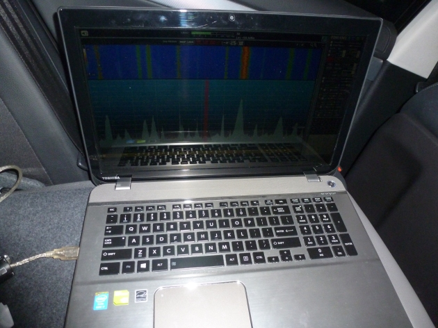
The fully charged laptop battery lasted over an hour during recording which was more than adequate. Nonetheless, a pure sine wave inverter and a fully charged 12 volt battery was packed in the boot in case of emergency.  That would only be required if the laptop’s juice fell short of expectations. That happened on the first trip … live and learn.

Final trip inside car

Fortuitous VHF services from the capital on 7 and 10 were also receivable with this UHF yagi. In these photographs, the car is parked in the nearest park. This was probably about a kilometre from the broadcast site. Parking at the broadcast site likely not only looks suspicious, but presents a danger of saturating the tuner with excessively strong signals. So this nearby park suited the needs of the trip perfectly.

UHF yagi in the park

To record the automatic scans, free version of Bandicam software was used. The Gold Coast analogue broadcasts themselves were captured to the hard disk in the standard DVD compliant MPEG2 format using Honestech TVR. Fortunately, analogue recordings that are snowy can be later enhanced with Dscaler noise reduction software.

Final trip inside car

The tuner employed was a simple PCMIA Cardbus analogue TV card picked up for $10 from a Sydney computer wholesaler that was clearing out superseded technology. This cheap beast can be seen protruding from the left side of the laptop. Note the emergency food supplies. This blogger is getting hungry right now writing this!

Stationary in the carpark of Rosser Park, there was plenty of unusual FM stations to be savoured on the Blaupunkt factory radio. These included The Rebel from Stanthorpe on 97.1, The Breeze from Tenterfield on 102.5, News Radio broadcasts from Inverell and Warwick on 93.5 and 96.3 respectively and FM104.7 Grafton. At the inland lookout in North Tamborine on the first trip (illustrated by the photos at the top of the article) Ten FM from Stanthorpe on 98.7 and ABC New England on 99.1 were clearly audible. There may have been more distant FM signals, but time was of the essence. It is a steep descent back to the dirty city and takes concentration during the adverse weather conditions.

Don't Turn It Off! © 2010 dirac3000

Once complete, the day of the analogue switch off was quite historic. Surprisingly, there were a number of pieces focussing on the history of analogue television that aired on the commercial television stations, notably BTQ7. Perhaps not such a terribly niche project after all?

Duporth Avenue: Pt 1

Over the Easter holiday of April 7-9, an antenna was erected on the seventh floor of a high rise apartment building in Duporth Avenue, Maroochydore on Queensland’s Sunshine Coast. This will be a two part entry.

Part one will focus on the geography of the region. Aside from the aesthetic appeal, the topography (captured by professional photographers) has important effects upon long distance FM reception and even permanent reception! Part two shifts focus onto the receiving system including MP3 recordings, photographs of the antenna system (with the panorama in the background), troposcatter from the north and the visual logbook of signal paths.

Receiving location

Local UHF television and FM radio broadcast sites were situated 23 kilometres south-west and 18 kilometres west of the receiving location. The elevation at the receiving location was 14 metres above sea level according to Hey, What’s That? path profiler. The Sunshine Coast Airport was located seven kilometres north, or a 12 minute drive according to Google Maps.

Within the surrounding few kilometres, the urban high rise strips in Duporth Avenue, Cotton Tree, Maroochydore Beach (high rise pictured), Alexandra Headland and Mooloolabah Beach are likely to have attenuated signals to the south-east.

Perhaps signal attenuation has positive effects. The result is a relatively empty FM band which is potentially far easier for achieving Sporadic E FM reception than another urban city such as Brisbane or the Gold Coast.

Hey, What’s That? theoretical path analysis

Significant path obstructions existed to the south and south-west according to the analysis. Aside from the aforementioned man-made concrete jungle, five kilometres to the south was Buderim Mountain range, pictured.

According to the Centre for the Government of Queensland at the University of Queensland:

…the Buderim formation has an elevation of under 200m and is more a rising plateau which extends for about seven kilometres. It has red soil, impregnated with iron oxide.

Also on the Buderim plateau, nine kilometres west was Kiels Mountain (151 m). Still focussing on the south and south-west, the most prominent terrain obstacles were these volcanic plugs .

The Glasshouse Mountains (pictured above & below) include Mellum (406 m, 26 km), Beerwah (556 m, 35 km) and the Tunbubudla Twins (338 m, 41 km). The D’Aguilar range presented another significant path impediment, including Mount Mee (501 m, 58 km).

The panorama to the north-west was ‘clear sailing’ according to Hey, What’s That? Eight kilometres north is Mount Coolum (207 m), the subject of the three photos below. Much further afield were the mountains of Eerwah (340 m, 26 km) and Cooroy (409 m, 28 km). The summit of Point Glorious was 25 kilometres west.

According to the Sunshine Coast Council:

Mount Coolum is a volcanic plug, 681 feet in height, rising from the coastal plain and with part of its base projecting into the ocean to form Point Arkwright.

Coolum district was the traditional land of the ‘Inabara’ or ‘Yinneburra’ clan of the Undanbi tribe of Aboriginal people, which was in turn part of the larger group known as the Kabi Kabi (or Gubbi Gubbi).

From the location of the antenna on the apartment balcony, the panorama (not pictured in this entry) included Mount Coolum in the distance.

The panorama from the north-northwest to the south-east was free of obstructions courtesy of the Coral Sea! Unfortunately there is no land in that direction to permit troposcatter. The largest islands towards the east are the southern tip of New Caledonia and the northern tip of New Zealand. During summer Sporadic E would be possible from these locations with respective hop distances between 1,435 – 2,208 kilometres according to the FM Scan Sporadic E Index.

Permanent troposcatter from the south

The path analysis suggests that the Buderim plateau may prove an obstruction five kilometres to the south and south-west.

Significant attenuation of signals to the south prevented reception of the Redcliffe community station just 66 kilometres away. Whilst it was very suprising at the time, the explanation now seems clear. The obstructions in the Redcliffe path include the Bribie Island National Park on Bribie Island (pictured) and the Glasshouse Mountains. Gold Coast stations 154 kilometres away were audible via troposcatter from time-to-time. The use of directional antenna arrays may explain why the Gold Coast broadcasts were not permanent non-DX signals. Suburban community stations were audible without issue from the Logan and Wynnum-Manly regions.

Towards the south-south-west and south-west, the Passchendaele and Toowoomba city broadcasters were audible without issue. Not much impedes a 244 km 80 kilowatt ERP national broadcast from Mount Magnus (962 m) near Stanthorpe. Similarly, the Toowoomba city elevation offset the southwest obstructions up to 156 km for the commercial (10 kW) and community (4 kW) broadcasters.

Permanent troposcatter from the west

Significant attenuation of signals to the west impeded high quality reception of CFM Kingaroy (15 watts) broadcasting merely 122 kilometres distant and CFM Dalby (600 watts) 187 kilometres distant. The obstructions to the westerly path include the Conondale National Park (pictured) situated between Jimna and Kenilworth. The Conondale National Park (328 m) is home to a number of beasts including the mountains of Langley (868 m), Allen (593 m) and Gerald.

In addition, the broadcast sites to the west (Kingaroy & Dalby) were obstructed by the volcanic Blackall range situated between Maleny (pictured) and Montville. Blackall range has an average altitude of 500 metres according to the Oxford Student Atlas. This hinterland region averages 450 metres according to Hinterland Tourism.

The attenuation may have been worsened by the highrise building itself. The location of the balcony provided maximum opportunities for eastern paths only. (Again, it must be conceded that there is no land or islands in that direction). However, pointing the antenna west was unlikely to penetrate the concrete and elevators. Improved signals from the west may have been achievable in the car.

Acknowledgments & References

This blogger is indebted to the authors of the following websites or publications which provided data used for the above commentary.

Bonzle Digital Atlas
Cocky Flies
Department of Environment and Resource Management
Explor Oz
FM List
Google Maps
Hey What’s That?
Hinterland Tourism
Oxford Student Atlas of Australia
Queensland Places
Sunshine Coast Council
UBD Street Directory of Brisbane

The copyright holders of photography included on this blog have licensed their works under the Creative Commons for non-commercial use (such as this not-for-profit blog) with attribution. To view more of their work, type the photographer’s name into Flickr.