Reflections at Lake Poona, Great Sandy National Pk & Rainbow Beach
May 14, 2014
Lake Poona bush walking (sans 4WD)
Lake Poona is accessible from Freshwater Road just west of Rainbow Beach. The lake comprises part of the Great Sandy National Park (NP). The park comprises some 220,000 hectares according to Bonzle and is tentatively World Heritage listed. The colourful Great Sandy NP (below) is sandwiched between Fraser Island & Tewantin – Noosa.
The Lake Poona walking track starts at the Bymien picnic area (map). This area is accessible via a loosely graded dirt road which is officially deemed suitable for 2WD vehicles.
To access the lake, a challenging walk (4.2 km / 2.6 mi return) is required. There is no direct vehicular access to Lake Poona. With a couple of short breaks, the walk took 43 minutes for its first half. Based on alitmeter readings, the elevation rises from 183 m (600 ft) to well over 240 m (787 ft) through the mid-point of the walk. Because of small rocks that are loose underfoot on the track, undertaking the walk is particularly challenging in the dark, even by torch light! It is therefore recommended to leave the lake and commence the return half of the walk at least half an hour prior to sunset.
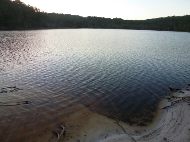
The colour of the water in Poona Lake (above) is distinctive. It forms as a result of tea tree leaves that fall into the water. The pristine lake tastes good; the home brewed ale afterwards in the apartment… even better! This blogger roughly estimates that the lake is at least 226 m (741 ft) wide and 574 m (1,883 ft) long… assuming seasonal rainfall maintains its capacity! The expansive lake can be easily seen from an aircraft. Fishing enthusiasts should be aware that reports suggest that fishing in Poona Lake is unlikely to be a fruitful endeavour!
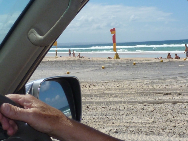
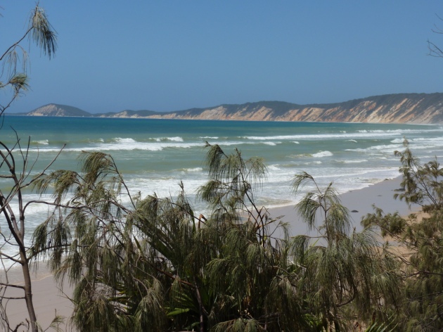
The walk, which culminates at the south east corner of the lake, seems to be surprisingly unpopular. Even on a busy summer Sunday, with the Rainbow Beach patrolled surf beach ‘pumping’ nearby (above), only two thirty-something walkers were seen during the course of the walk.
Despite the obvious potential (above), there was no swimming undertaken on this occasion due to lack of time. The time of arrival was 5:30 pm. About three minutes were spent on a brief survey of FM radio reception. This act of madness was done discreetly, when nobody else was around.
Only very rudimentary portable radio equipment (below) was able to be taken on the bushwalks. Frozen water bottles, insect repellent, a ‘smart’ phone (apparently?), torches & two video cameras take precedence!
At the lake, signals from Bundaberg (93.9 MHz, N), the Darling Downs (100.7 MHz, SW) & the Gold Coast (89.3 MHz, S) at a distance of 224 km (139 mi) were clearly audible on the Tecsun PL-300WT (below). The 80 kW FM western ‘beasts’ broadcasting from Biggenden (116 km / 72 mi) were so strong the signals were bleeding onto adjacent channels such as 99.5 MHz. Jet-scattered transient signals from Coffs Harbour were NOT receivable at the lake. Tropospheric Index: light blue.
The highest point of the walk is roughly about one kilometre from the lake. At this point is a grassy clearing of about 25 square metres (269 square ft) with a basic selection of log ‘seating’ to recharge one’s depleted physical ‘batteries’. Unfortunately, the towering trees nearby attenuated FM signals at this area. This seemed to negate the benefit of the higher altitude, as signals listed above that were clear at the lake were noticeably absent.
Great Sandy NP radio observations
In contrast to Lake Poona, at two locations a short drive away, Coffs Harbour’s RN on 99.5 MHz would ‘boom in’ via jet reflection at this time of day. These were accompanied by daily late afternoon showers which were likely indicative of flat atmospheric conditions. These two trips are detailed below:
A third of the way (3 km / 1.9 mi) to Neeb’s Waterhole (map), the tour was forced to stop on a hill (where the road parts in two directions) that is roughly estimated to be 50 m (164 ft) ASL using Google Earth. Access to the waterhole was previously possible via Mullin’s carpark through Cooloola Way with a 4WD vehicle (that is, four-wheel drive or SUV, sport utility vehicle) but is now closed for repair to all traffic due to severe flood damage, which necessitated turning the vehicle back.
On this hill in Cooloola Way, the extensive 4WD metal body (below) was used as a highly effective ground plane. The radio was placed on the high roof of the vehicle. The Tecsun radio battery ground was connected to the roof and the telescopic antenna fully extended vertically. The base of the telescopic antenna is NOT touching the metal roof, only the ground wire does.
This yielded far better results than the 4WD factory radio. As seems to be commonplace, the Toyota’s telescopic antenna was too short. The FM telescopic wasn’t captured on film, but is probably only two-thirds of the length of the portable receiver’s telescopic antenna. Worse, the factory receiver did not feature sufficient selectivity for the modern congested FM band.
Although worthwhile for long distance FM reception, this ‘portable on the roof’ approach unfortunately yielded this crazed enthusiast dozens of insect bites that affected ‘sleep quality’ for the remainder of the vacation!
The highlights were Stanthorpe (103.3 MHz, SW) & Coffs Harbour (99.5 MHz, S) at distances of 302 km & 476 km (286 mi) respectively. A ‘rebelliously-strong’ signal from Beaudesert (90.5 MHz, S) was a pleasant surprise at 210 km (130 mi). It’s hard to maintain interest when insects are feasting on the back of one’s knees, but signals towards the north & west seemed lacklustre with nothing obvious further than moderate strength Bundaberg, 146 km (91 mi)! Tropospheric Index: unknown.
At the Tin Can Bay Volunteer Coast Guard (map), a simpler arrangement was used since a conventional vehicle was able to be used. Obviously this is more convenient (translation: ‘bite free’ comfort) & yields superior results to a portable receiver sited in the ‘middle of nowhere’, although perhaps it does not offer as much ‘quirky’ enjoyment. Again, a Blaupunkt ‘Sharx’-enabled radio with an amplified Shark Fin (an appropriate match for pun enthusiasts?) was effective, as is regularly used.
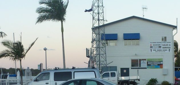
The car was driven to a parking space overlooking Snapper Creek near the Coast Guard’s antenna arrays (above). At this spot, Bundaberg (93.9 MHz, N) & Brisbane (104.5 MHz, S) were strong. Satisfactory reception was possible from Redland Bay (100.3 MHz, S), Ipswich (94.9 MHz, S), the southern Gold Coast (95.7 MHz, S), Beaudesert (89.7 MHz, S), Cherbourg (94.1 MHz, W) & Coffs Harbour (99.5 MHz, S) at a distance of 491 km (305 mi). North-western signals from Gladstone (93.5 MHz) & Rocky (103.1 MHz) at respective distances of 287 km & 348 km (216 mi) were weak. Tropospheric Index: dark blue.
Great & Sandy but dense terrain
The Great Sandy NP comprises many ranges of dense rainforest. Not only does this result in exhausting 4WD driving for relatively inexperienced drivers (like this long-suffering writer) but these terrain characteristics also pose a significant obstruction for long distance FM reception towards the south at Rainbow Beach.
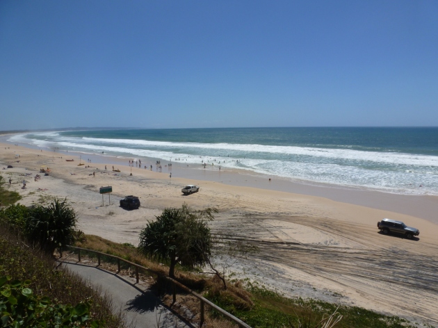
Conversely, it is highly likely that this is also the reason for the FM reception deficiencies at Noosa towards the north, discussed in previous posts. Tewantin – Noosa is located near the southern boundary of the park. One afternoon, when checking briefly on the 4WD on the beach near the Freshwater camping & day use area (below) a haul of southern stations were found. These included the Gold Coast and were easily detected in flat conditions. Freshwater’s facility is NE of Teewah Beach, accessible by 4WD.
Much like Noosa, reception to the north west is obstructed by mountains. Fishing, surfing, swimming, walking, backyard cricket or drinking is probably a more fulfilling way for prospective campers to pass the time in this part of the park (below) than playing with a portable FM receiver!
Located NE of Freshwater camping & day use area is Double Island Point Conservation Park. Atop a cliff is the popular lighthouse attraction, accessible via walking track (below). The Double Island Point lighthouse has operated since 1884. The ‘light’ which guards passing ships from the rocky headland is supplied via solar electric panels. The lighthouse is an official weather station, often featured on television.
Rainbow Beach accommodation (sans 4WD)
Rainbow Beach (below) has a ‘party-like’ tourist atmosphere. To this writer, this felt reminiscent of Airlie Beach, the gateway to the Whitsunday Islands without the oppressive tropical summers. Granted, there is not the variety of restaurants & nightlife the Airlie Beach destination offers. Both destinations share the same sub-tropical climatic classification.
Rainbow Beach seems particularly popular with Dutch, German, Polish & Swedish twenty-something tourists. During the week, the location (cue The Specials’ classic, please deejay) almost resembles a ‘Ghost Town’!
It’s probably unsurprising as there is barely one school and no major supermarkets in the locality, with the overwhelming emphasis on tourism. Nearby Tin Can Bay seems to be the business, residential & recreational fishing and hub of the region.
Rainbow Beach’s weekday ‘slumber’ (above) is perhaps ideal for exploiting Rainbow Beach’s wonderful potential for FM reception. It is remote! How remote? The only local broadcast is a one watt Christian FM narrowcaster; on MW it is Classic Hits 4GY. The region only requires 75 watt digital television translators.
Tropospheric Ducting: Pack a yagi or get high!
Even during instances of ‘fair’ tropospheric ducting in mid-March (Autumn), distant reception is awesome. These were indicated by a light blue colour on the Hepburn tropo forecasts, easily viewed via even the most rudimentary cellular phone. (Conditions were confirmed after the vacation ended using the Marine Tracking peaks on the graphs at Gladstone).
Long distance FM reception from the north west as far as Mackay (687 km / 427 mi) is possible at Rainbow Beach. Just as rewarding is hearing the numerous low-powered mine relays from the same azimuth, rebroadcasting commercial stations Zinc (aka 4CC), Sea FM, Rebel & Breeze.
In total, 92 FM stations were logged at Rainbow Beach over three evenings. These included two re-broadcasts of cable television sporting channels, typically servicing large caravan parks.
As mentioned above, the obstructive nature of the Great Sandy NP at Rainbow Beach enable FM broadcasts from Gladstone (292 km / 181 mi) to obliterate those on the Sunshine Coast (100 km / 62 mi). This is a very pleasing terrain side effect, since the Gladstone broadcasts emanate from a low-elevation site with a tenth of the power of the coast stations!
Access to a collapsible three or five element FM yagi (from $45) is recommended for receiving pleasant ‘quieting’ signals from the north west (such as Mackay) in Rainbow Beach. Not all accommodation may be ideally suited for the placement of a ‘stealth antenna’. Huh? Essentially, a stealth antenna in this context refers to the erection of a tripod-mounted small yagi on the balcony during darkness between 7 pm – midnight. A folded dipole resting on a balcony’s glass or wooden table may suffice. (The dipole is easily detached from a surplus five or eight element FM yagi).
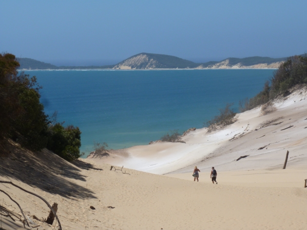
Rainbow Beach’s elevated region is characterized by a gradual rise from beach level (i.e. the Pacific Ocean) to 87 m (285 ft) near the Cooloola Drive reservoirs. These water towers adjoin the extremely popular Carlo Sand Blow lookout (108 m / 354 ft ASL), so these are easy to spot! The Sand Blow is pictured above & below.
Unless one is lucky enough to secure scarce accommodation located around here (the author did not), experimentation with a portable receiver’s telescoping monopole antenna is virtually guaranteed to be frustrating as the effects of a federal budget! Unlike many holiday locations, at Rainbow Beach there are simply no towering high rise apartments on offer. Typically towers partially offset the performance of a ‘lossy’ telescoping antenna.
Provided one pays attention to the hilltops and gets mobile, there are still plenty of other alternative methods to ‘get in on the action’. In fact, one evening the Mackay stations were even audible via tropo in the car, albeit only on the western crests of Rainbow Beach Road. Reception from this north western azimuth seems optimal when this road transitions into Tin Can Bay Road, approaching Wolvi near Gympie. Signals from Mackay were typically heard just above the noise floor.
Distance calculations computed using FM Scan, with base (apartment) reception undertaken with a Yamaha TX-930 component tuner.
Photographs may be freely used for non-commercial activity, provided attribution is given. Should readers choose to use those photos elsewhere, please link back to this page or attribute this blog as the copyright holder. Please click on the photos to access higher resolution shots (2048 x 1536 pixels).


