Eumundi & Doonan
September 18, 2013 1 Comment
This radio feature provides coverage of Eumundi and Doonan, inland suburbs of the Sunshine Coast. The coast is a highly populated region comprising part of South East Queensland. Coincidentally, both these suburbs are included within the voting boundaries that encompass the much-publicized Australian federal seat of Fairfax.
Eumundi is known both for its markets (below) and the Eumundi brewery. In the 1990s, the independent brewery manufactured the boutique Eumundi Lager, widely acclaimed amongst beer connoisseurs.

According to UQ’s Centre for the Government of QLD:
Eumundi, a rural village in hilly country around the upper reaches of the North Maroochy River, is 15 km inland from Peregian Beach and 110 km north of central Brisbane… Eumundi was a timber harvesting area, and a small European settlement emerged in the 1880s.
Next to Eumundi is Doonan, a relatively new suburb which did not exist in directories until the late 1990s. A relatively new street called Panorama Drive (not developed until after 1998) serves as a translator site for the commercial MW and FM stations servicing the Noosa shire. The site encompasses Bicentennial Lookout.

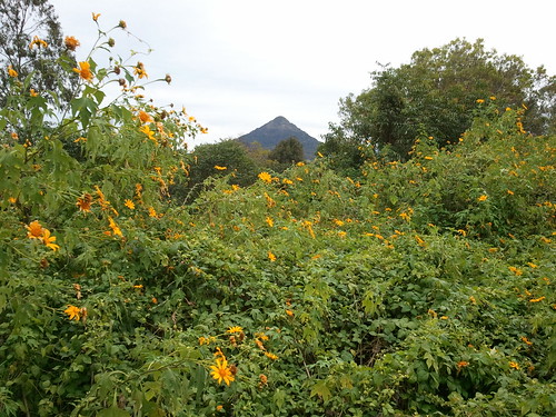
For tourists, the hill in Doonan provides access to 360 degree views towards Mount Cooroy and Noosa Heads. Gillian Everett captured some of the best views, which are now sadly obscured for daytrippers.
There is a golf course near the site, reminiscent of Mount Tamborine on the Gold Coast.

Broadcasters Classic Hits 4GY and Zinc 96 relay (that is, rebroadcast) their Gympie-sited transmissions from this site on the frequencies of 107.1 and 100.5 MHz respectively.

This modest sized tower is likely to be adequate for the provision of ‘black spot’ FM coverage.

It is well established that Noosa shire has known television and radio signal obstructions from the north.

The signal deficiency is likely caused by the region’s rugged terrain.

Perhaps the extensive Great Sandy National Park (north; stretching from the Noosa North Shore to Fraser Island), the Tewantin National Park (west) and the portions of Noosa National Park (east) are the most likely physical impediments to the UHF and FM band signals. Noosa NP is pictured above whilst Fraser’s Great Sandy NP appears below.

There are also translators sited in Tewantin, five kilometres north. At Tewantin, broadcaster Hot 91 relays the Maleny-sited transmissions to the Noosa shire. All Maleny television services are also rebroadcast at this site.

The prevalence of national parks in the Noosa shire are one of the reasons that residents and tourists often suggest that the area is so special and relatively untouched.
In 2008, the Beattie Labor government in the state of Queensland mandated the removal of 156 Queensland ‘shires’ (that is, local government areas) to form just 73 ‘super councils’. The goal was to reduce inefficiencies in public service provision to the community by utilizing economies of scale. The Noosa shire was impacted by this, disappearing to became part of the formidable Sunshine Coast ‘super council’. The natural forest in the region has likely been protected by legislation through the recent reinstatement of the Noosa shire.
Further reading on this region
- Original Eumundi: The Coast’s famous markets (pr.wyndhamvrap.com)
- Maroochydore (shortysrvadventures.com)
- Sunshine Coast (ozeastcoast2013.wordpress.com)
- Noosa Country Show – The Grand Parade (irenewaters19.com)
- Twenty things to do in Noosa for under $20 (nomadsworld.com)
- Petitioning Mr Palmer (change.org)
- Sounds of the Noosa shire (fmdxing.wordpress.com)
- Laguna Lookout & Mt Tinbeerwah (fmdxing.wordpress.com)
